Whether it’s the South China Sea or the most distant regions of Tibet, China is always trying to lay claim to more territory. This week China published an annual map which now includes a region controlled by India as part of China.
The map was released Monday on the Chinese Ministry of Natural Resources standard map service website, just days after the two nations agreed to work to ease tensions at their disputed border.
The map also includes Taiwan and the South China Sea as Chinese territory.
Here’s an image of the full map:
The 2023 edition of China's standard map was officially released on Monday and launched on the website of the standard map service hosted by the Ministry of Natural Resources. This map is compiled based on the drawing method of national boundaries of China and various countries… pic.twitter.com/bmtriz2Yqe
— Global Times (@globaltimesnews) August 28, 2023
But the areas of contention are shown in this map created by Reuters:
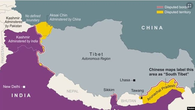
The triple line shows what’s known as the Line of Actual Control. Despite the name, this line is not well defined and never has been. But what is clear is that the area in yellow on the left side of the map is controlled by China but claimed by India. The area in yellow on the right side of the map is controlled by India but claimed by China. It’s this latter area which China’s new map lists as “South Tibet” and part of their territory. India is making a formal protest over the new map.
“We reject these claims as they have no basis,” India’s foreign ministry spokesperson Arindam Bagchi said.
He added that such steps by China “only complicate the resolution of the boundary question”…
India’s Foreign Minister S Jaishankar also called China’s claim “absurd”.
“China has even in the past put out maps which claim the territories which are not China’s, which belong to other countries. This is an old habit of theirs,” he told TV channel NDTV on Tuesday.
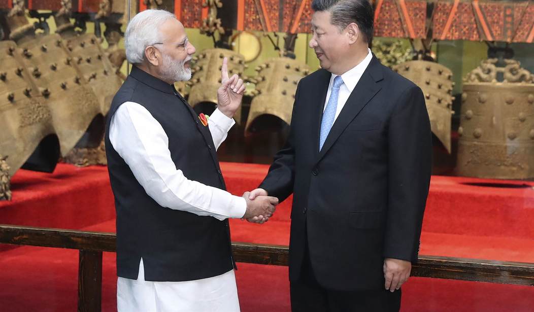
The leaders of China and India just had informal talks about this issue last week.
Last week, Indian Prime Minister Narendra Modi informally spoke to China’s President Xi on the sidelines of the BRICS summit in Johannesburg, where the premier highlighted New Delhi’s concerns about their unresolved border issues.
India’s foreign ministry said the two leaders agreed to intensify efforts to de-escalate tensions at the disputed border and bring home thousands of their troops deployed there.
Clearly, Xi Jinping wasn’t interested in de-escalating tensions. You may recall that back in 2020 there were battles between Chinese and Indian soldiers. No guns were involved but the soldiers did fight with clubs and rocks and about 20 Indian troops were killed. China reportedly suffered 43 casualties though the number who died is unclear. Those clashes were apparently created by Chinese incursions into Indian territory.
The problem arose when an Indian patrol visited the area near a ridge to verify a Chinese assertion that its troops had moved back from the LAC, the two government sources aware of the military situation said.
The Chinese troops had thinned out and left behind the two tents and small observation posts. The Indian party demolished the towers and burnt the tents, the sources said.
The satellite images show possible debris from the observation posts on Tuesday morning on a ridge on India’s side of the LAC. There was no such structure in the image taken a week earlier.
China’s soldiers responded to the burning of the observation posts by going on the attack. And those skirmishes along the border continued into 2021. Ever since then, things have been tense between China and India. So the decision to publish this map laying claim to a large area currently controlled by India is a pretty clear provocation. Xi Jinping is poking India in the same way he is poking Taiwan and the Philippines. He is constantly pushing and trying to see what he can get away with.


Join the conversation as a VIP Member